Skip to main contentResource added 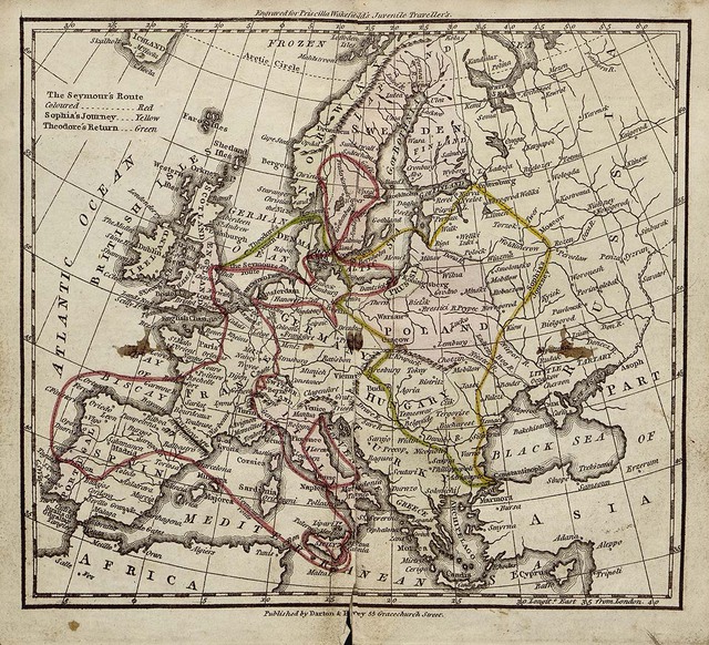
Priscilla Wakefield, The Juvenile Travellers, map
A fold-out map attached at the end of The Juvenile Travellers by Priscilla Wakefield, published by Darton and Harvey, 1801. Images are available for download through the Digital Collections of the George A. Smathers Libraries, University of Florida, 23h22030. https://ufdc.ufl.edu/AA00031642/00001/images/3
Full description
This map shows the route of the family from Wakefield’s book as they travel through Europe. Readers can follow the journey on the map as they read, a practice typically recommended in the prefaces of fictionalized geography books for children. Although Wakefield included maps in her books, other geographers did not, with the expectation that readers could find a globe or map in their home.
- typeImage
- created on
- file formatjpg
- file size427 KB
- container titlePriscilla Wakefield, The Juvenile Travellers; Containing the Remarks of a Family During a Tour Through the Principal States and Kingdoms of Europe: With an Account of their Inhabitants, Natural Productions and Curiosities (London: Darton and Harvey, 1801).
- creditCourtesy of the Baldwin Library of Historical Children’s Literature, George A. Smathers Libraries, University of Florida
- rightsPublic domain
Manifold uses cookies
We use cookies to analyze our traffic. Please decide if you are willing to accept cookies from our website. You can change this setting anytime in Privacy Settings.